 vesseltracker.com
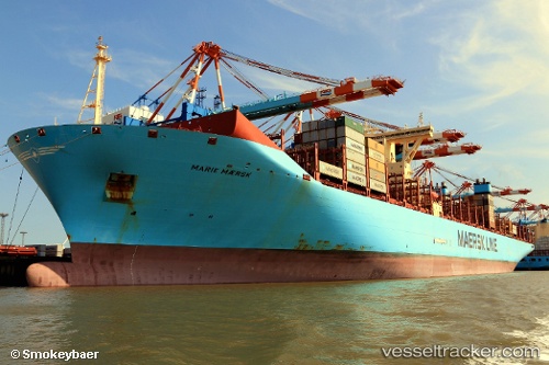
Vessel Marie Maersk IMO: 9619933, MMSI: 219018765 Container Ship
UTC, 4.55920, -13.24588, course: 327, speed: 20
UTC, 5.22662, -13.70990, course: 326, speed: 20
2026-03-12 21:14:01 UTC, 5.51197, -13.90842, course: 326, speed: 20
Live Vessel Marie Maersk Analytics (details, animations, etc.)
Live AIS position: UTC. 149 nm SW of YORK), updated 2026-03-12 21:14:01 UTC.Find the position of the vessel Marie Maersk on the map. The latter are known coordinates and path.
marine traffic ship tracker show on live map
The current position of vessel Marie Maersk is 5.51197 lat / -13.90842 lng. Updated: 2026-03-12 21:14:01 UTCCurrently sailing under the flag of Denmark
Marie Maersk built in 2013 year
Deadweight:
194327 tDetails:
Last coordinates of the vessel:
UTC, 4.01088, -12.86522, course: 326, speed: 20.4UTC, 4.55920, -13.24588, course: 327, speed: 20
UTC, 5.22662, -13.70990, course: 326, speed: 20
2026-03-12 21:14:01 UTC, 5.51197, -13.90842, course: 326, speed: 20